Since mid-September 2022, NASA-funded instruments have been hitching rides on commercial aircraft and collecting environmental data over New Zealand. The collaboration with Air New Zealand is the first known data-collecting partnership between a passenger airline and a NASA Earth science mission.
The new program is part of NASA’s Cyclone Global Navigation Satellite System (CYGNSS) mission, which is a constellation of eight small satellites that collect data on the intensity and direction of storms and hurricanes. Flying in low-Earth orbit above the tropics, the CYGNSS satellites were designed to measure wind speeds over the ocean by examining reflections of GPS signals from choppy and calm water surfaces.
After the satellites were launched in 2016, scientists found that CYGNSS technology could also capture valuable measurements of wetlands, flood events, and soil moisture. That's where the Air New Zealand partnership comes in. Attaching GPS radar receivers to commercial aircraft offers a new way to observe features of wetlands and rivers that are often hidden from view in visible-light imagery by thick vegetation.
Read more at NASA
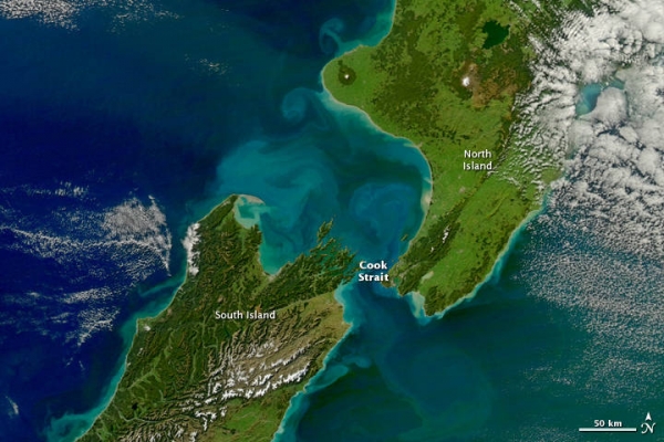
Image: Runoff from heavy rains, combined with wave action along the coast, increased the turbidity of New Zealand’s waters (note the discoloration between the country's north and south islands) when this image was acquired on April 29, 2011 by the Moderate Resolution Imaging Spectroradiometer (MODIS) on NASA’s Aqua satellite. (Credits: NASA/Norman Kuring)