New research from Colgate University changes our understanding of seasonal thawing in parts of Antarctica, as scientists have learned that summer thawing occurs nearly a month earlier, and stays thawed for a full two months longer, than previously believed.
The research, “Timing and duration of ephemeral Antarctic water tracks and wetlands using high temporal-resolution satellite imagery, high spatial-resolution satellite imagery, and ground-based sensors in the McMurdo Dry Valleys,” is published today in Arctic, Antarctic, and Alpine Research.
Researchers, including Assistant Professor of Earth and Environmental Geosciences Joe Levy, used newly available satellite imaging from Planet, which can scan the surface of the Earth daily or even multiple times per day. The new stream of data is having a major impact, as researchers in the past had to rely on far fewer satellite images, or had to make the voyage to Antarctica to conduct soil measurements in person.
Read More: Colgate University
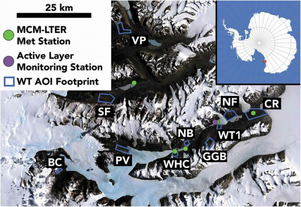
Site map showing the location of water track study areas (AOIs), the spatial footprint of the AOIs (blue rectangles), the location of MCM-LTER meteorological stations used for ground temperature comparison (green dots), and the location of the active layer monitoring station used to determine water track hydroperiod at one site (purple dot). Base map is the Landsat Image Mosaic of Antarctica (Bindschadler et al. 2008). Inset shows the location of the McMurdo Dry Valley study area in the red box. (Photo Credit: Joe Levy/Colgate University)


