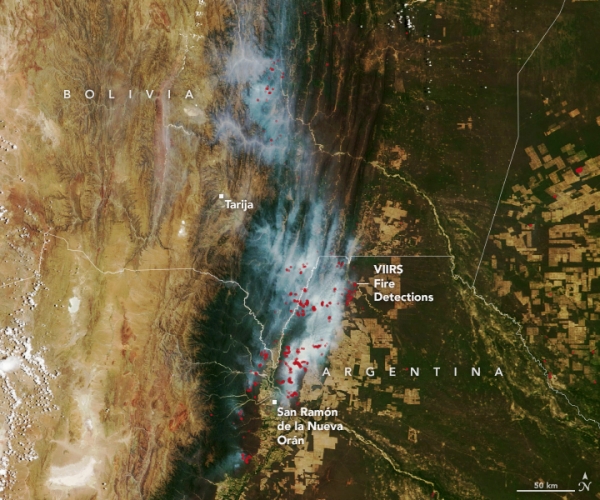
In November 2022, several months into Argentina’s fire season, burning was evident in the country’s northwest.
Smoke from the wildland fires is visible in this natural-color image, acquired on the morning of November 27, 2022, with the Moderate Resolution Imaging Spectroradiometer (MODIS) on NASA’s Terra satellite. Red dots indicate the locations of active fire detections observed by the Visible Infrared Imaging Radiometer Suite (VIIRS) on the NASA-NOAA Suomi NPP satellite later that afternoon.
Most of the fires shown here are burning in Argentina’s Salta province, with some showing up to the south in Jujuy province and to the north in Bolivia. According to Flavio Speranza, a forestry engineer at Argentina’s National Institute of Agricultural Technology (INTA), the fires were burning across several forested ecosystems: subtropical forests at low and middle altitudes, and premontane and montane forests on mountain slopes.
Read more at: NASA Earth Observatory
Forests are burning after being primed by warm temperatures and a lack of rain. (Photo Credit: NASA Earth Observatory)


