A large, slow-moving landslide is accelerating in eastern Congo, putting a community at risk. New research exposes geologic hazards amid unprecedented urban sprawl.
Creeping from just a finger’s width up to a few feet per year, slow-moving landslides occur naturally throughout the world. They typically are detected inching downslope in rocky areas with high seasonal precipitation and clay-rich soil, and they can take months to years – even centuries – to develop. Yet they can also bring sudden violence. Thousands of landslides are flowing, slipping, toppling, and sliding down hills from coastal California to China’s Three Gorges Reservoir. How these stealthy geologic phenomena respond to urban development has not been well understood.
Now a team of international researchers, including one from NASA’s Jet Propulsion Laboratory, has combined satellite and archival imagery to show how one African city’s changing water usage influences land movements near and just below the surface.
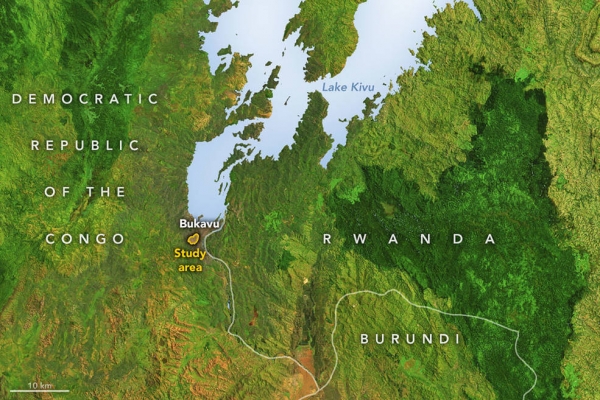
The new study zeroed in on Bukavu, a hillslope city in the Democratic Republic of the Congo. The researchers noted that Bukavu – with a population estimated to double to more than a million inhabitants by 2030 – is emblematic of many cities in the developing world that have seen rapid and unplanned growth on tectonically active landscapes. The city, originally established along the flat shoreline of a lake, has been expanding up steep slopes. Along the way, parts of Bukavu have experienced slow, ongoing destruction of infrastructure due to ground surface motion.
Read more at NASA
Image: This map shows the location of the Funu landslide, outlined in yellow, in Bukavu, which is on the southern shore of Lake Kivu in eastern Congo. The image is a false-color mosaic created with data (not used in this study of the landslide) from the Landsat 8 and Landsat 9 satellites. (Credits: NASA Earth Observatory)