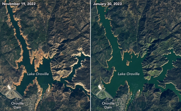
In the wake of a series of destructive storms in late December and early January, California’s long-ailing mountain reservoirs have risen, satellite images from NASA show.
Lake Oroville, which sits in the northern reaches of the Sierra Nevada mountain range, was at just 28 percent of capacity in late November and is now at 69 percent capacity, following the winter deluge. Long depleted by drought, the reservoir is now close to its historical winter level. Lake Shasta, in far northern California, was at just 31 percent of capacity in late November and is now at 58 percent capacity, bringing it in line with the historical average.
Recent storms “certainly helped reservoir storage in California following the driest three years in the state’s recorded history,” Jeanine Jones, an official with the California Department of Water Resources, told the Los Angeles Times. “Over the next two months, it is important that we still see periodic rain and snowstorms to keep an above-average pace for our precipitation totals.”
Read more at Yale Environment 360
Image: Lake Oroville before and after December's heavy rainstorms. (Credit: NASA)


