New hazard-monitoring technology uses GPS signals to go wave-hunting in the Pacific Ring of Fire. GUARDIAN’s long-term objective is to augment early warning systems.
Triggered by earthquakes, undersea volcanoes, and other Earth-shaking forces, tsunamis can devastate coastal communities. And when it comes to providing advance warning, every second counts. Scientists at NASA’s Jet Propulsion Laboratory are testing a novel approach to detect – from the far reaches of the atmosphere – the ocean’s deadliest waves.
Called GUARDIAN (GNSS Upper Atmospheric Real-time Disaster Information and Alert Network), the experimental monitoring system taps into data from clusters of GPS and other wayfinding satellites orbiting our planet. Collectively, these clusters are known as global navigational satellite systems, or GNSS. Their radio signals travel to hundreds of scientific ground stations around the world, and that data is crunched by JPL’s Global Differential GPS (GDGPS) network, which improves real-time positional accuracy down to a few inches (roughly 10 centimeters).
The new system sifts the signals for clues that a tsunami has arisen somewhere on Earth. How does it work? During a tsunami, many square miles of the ocean surface can rise and fall nearly in unison, displacing a significant amount of air above it. The displaced air ripples out in all directions in the form of low-frequency sound and gravity waves. Within several minutes, these vibrations reach the topmost layer of atmosphere: the Sun-cooked, electrically charged ionosphere. The ensuing clash of pressure waves with charged particles can distort the signals from nearby navigational satellites ever so slightly.
Read more at NASA
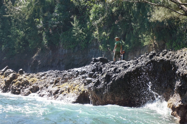
Image: Waves churn in Onomea Bay, Hawaii, where the sea rose by more than 30 feet (9 meters) during the deadly tsunami of April 1, 1946. Emerging technology could help detect these natural hazards via acoustic and gravity ripples they hurl towards space.
(Credit: M. Younger via NASA)


