The 1,200-mile-long Denali Fault stretches in an upward arc from southwestern Alaska and the Bering Sea eastward to western Canada’s Yukon Territory and British Columbia. The long-lived and active strike-slip fault system, which slices through Denali National Park and Preserve, is responsible for the formation of the Alaska Range.
“It’s a big, sweeping fault and the source of a magnitude 7.9 earthquake in 2002 that ruptured more than 200 miles of the Denali Fault, along with the Totschunda Fault to the east, causing significant damage to remote villages and central Alaska’s infrastructure,” says Utah State University geochemist Dennis Newell.
Understanding the restless fault’s mantle-to-crust connections provides critical information for understanding the lithospheric-scale fault’s seismic cycle, says Newell, associate professor in USU’s Department of Geosciences. He and colleagues Jeff Benowitz, an Alaska-based geochronologist, Sean Regan of the University of Alaska Fairbanks, and doctoral candidate Coleman Hiett of USU collected and analyzed helium and carbon isotopic data from springs along a nearly 250-mile segment of the fault and published their findings, “Roadblocks and Speed Limits: Mantle-to-Surface Volatile Flux in the Lithospheric Scale Denali Fault, Alaska,” in the June 1, 2023 print issue of the journal Geology.
The research was funded by a one-year National Science Foundation Early-Concept Grant for Exploratory Research (EAGER) awarded to Newell and Regan in 2020.
Read more at Utah State University
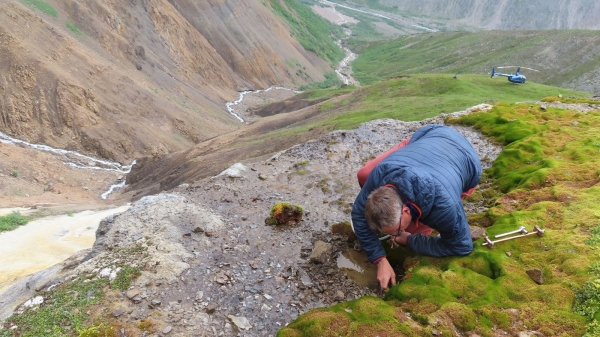
Image: USU geochemist Dennis Newell collects a sample from a spring along a remote segment of Alaska's Denali Fault. He reports evidence of mantle-to-crust connections that increase the possibility of a future major earthquake. (Photo Credit: Jeff Benowitz)


