Smoke from intense wildland fires in Canada billowed over the upper Midwest in June 2023, causing hazy skies and hazardous air quality in Canada and across several U.S. states.
The image above—acquired by the Moderate Resolution Imaging Spectroradiometer (MODIS) on NASA’s Aqua satellite—shows smoke drifting across Minnesota, Wisconsin, and North and South Dakota on June 14, 2023. Most of the smoke blew south from Canada, where blazes continued to rage across several provinces. Over 400 fires were active across the country that day, half of which were classified as out of control, according to the Canadian Interagency Forest Fire Centre (CIFFC).
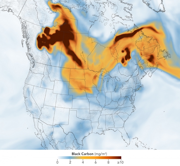
The image below highlights the density of black carbon particles—commonly called soot—in the smoke as it moved across North America. The black carbon data come from NASA’s GEOS forward processing (GEOS-FP) model, which assimilates data from satellite, aircraft, and ground-based observing systems. In addition to making use of satellite observations of aerosols and fires, GEOS-FP incorporates meteorological data like air temperature, moisture, and winds to project the plume’s behavior. The fine particulate matter (PM2.5) in this pollution can enter the lungs and lead to health problems.
Read More: NASA Earth Observatory
Photo Credit: Lauren Dauphin


