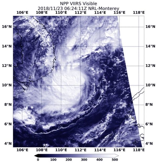
33W was a tropical depression when it crossed the southern and central Philippines. As it moved through the South China Sea over the last two days it strengthened into a tropical storm and was renamed Usagi. On Nov. 23, NASA-NOAA’s Suomi NPP satellite captured a visible image of the stronger storm on approach to Vietnam.
Suomi NPP passed over 33W on Nov. 23 at 1:24 a.m. EDT (0624 UTC) and the VIIRS instrument provided a visible image. The VIIRS image showed 33W had strengthened and its center was surrounded by powerful storms. Bands of thunderstorms wrapped into the low-level center from the southern quadrant.
Read more at NASA / Goddard Space Flight Center
Image: NASA-NOAA’s Suomi NPP satellite passed over the South China Sea and captured a visible image of Tropical Storm 33W moving toward Vietnam. CREDIT: NASA / NOAA / NRL