With the 2019 Atlantic Hurricane season underway, Woods Hole Oceanographic Institution (WHOI) is prepared to supply important ocean data that can help hurricane forecasters predict the strength of this year’s coming storms.
According to the National Oceanic and Atmospheric Administration (NOAA), this year’s hurricane season is projected to have a forty percent chance of being ‘near-normal’ with nine to fifteen named storms and two to four major hurricanes. To help gauge the strength or “intensity” of these storms, WHOI researchers have mobilized autonomous underwater vehicles (AUVs) and other instruments to measure changes occurring in the ocean before and during storms, and to transmit the data in near-real time.
“As a sea-going institution, WHOI has a long history of collecting ocean measurements,” said Robert Todd, an associate scientist in the Physical Oceanography Department. “In recent years, advances in autonomous technologies and satellite communication have made it possible for us to provide key ocean measurements to weather forecasting centers like the National Hurricane Center, even in the middle of hurricanes when ships and people cannot be safely at sea. These measurements help weather models better capture the ocean-atmosphere feedbacks that are critical to accurate storm forecasting.”
Read more at Woods Hole Oceanographic Institution
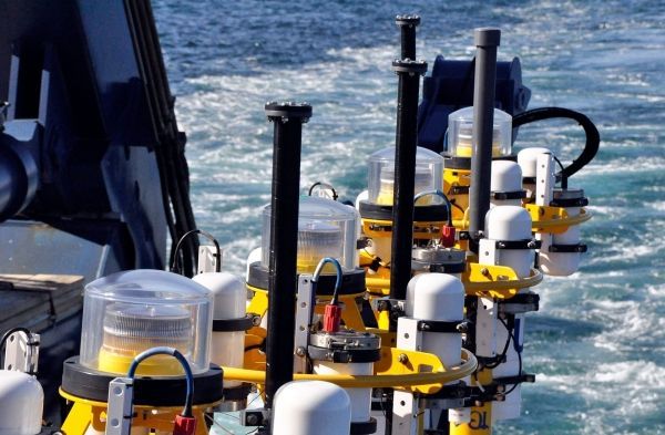
Photo: The Pioneer Array includes a variety of instruments that can measure ocean conditions during hurricanes. This includes Coastal Profiler Moorings, which are shown here on the R/V Atlantis prior to deployment. (Photo by John Lund, Woods Hole Oceanographic Institution).