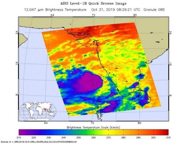
Tropical Cyclone Maha continued to move north along the southwestern coast of India when NASA’s Aqua satellite passed overhead and analyzed the cloud top temperatures. Satellite imagery showed the storms with the greatest rainfall potential were over the Lakshadweep islands.
One of the ways NASA researches tropical cyclones is using infrared data that provides temperature information. Cloud top temperatures identify where the strongest storms are located. The stronger the storms, the higher they extend into the troposphere, and the colder the cloud temperatures.
Tropical cyclones do not always have uniform strength, and some sides are stronger than others, so knowing where the strongest sides of the storms are located helps forecasters. NASA then provides data to tropical cyclone meteorologists so they can incorporate it in their forecasts. The AIRS imagery appeared to show those strongest storms were on the eastern side of Maha.
Read more at NASA / Goddard Space Flight Center
Image: On Oct. 31 at 4:29 a.m. EDT (0829 UTC) NASA’s Aqua satellite analyzed Tropical Cyclone Maha using the AIRS instrument. AIRS showed the strongest storms were located over the Lakshadweep Islands where the coldest cloud top temperatures as cold as or colder than 210 Kelvin (purple) minus 81 degrees Fahrenheit (minus 63.1 degrees Celsius) around the center. Credit: NASA JPL/Heidar Thrastarson