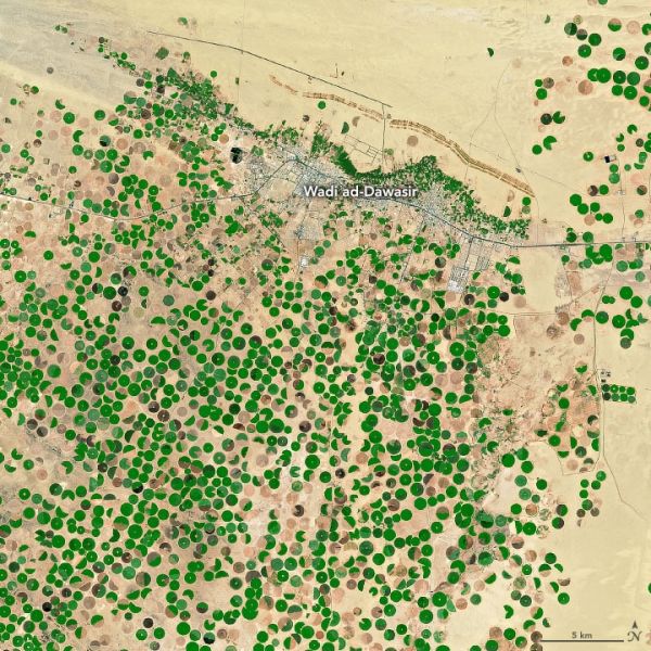
The kingdom of Saudi Arabia spans 2.1 million square kilometers (830,000 square miles)—an area larger than Alaska and Texas combined—yet it has no permanent rivers or standing lakes. What it does have are wadis, valleys that are transformed into ephemeral rivers after storms, and aquifers with groundwater.
This pair of images captures the spread of agriculture around the town of Wadi ad-Dawasir. Groundwater and irrigation have been used to green-up portions of the desert in Saudi Arabia. The images were acquired by the Advanced Spaceborne Thermal Emission and Reflection Radiometer (ASTER) on NASA's Terra satellite in 2000 and 2017. Since the area receives less than 200 millimeters (8 inches) of rain per year, farmers make use of pumped groundwater and center-pivot irrigation systems to grow crops—mainly wheat, alfalfa, and vegetables.
Continue reading at NASA Earth Observatory
Image via NASA Earth Observatory


