University of Cincinnati geography researchers have identified a tipping point for deforestation that leads to rapid forest loss.
Geography professor Tomasz Stepinski used high-resolution satellite images from the European Space Agency to study landscapes in 9-kilometer-wide blocks across every inch of the planet between 1992 and 2015. He found that deforestation occurs comparatively slowly in these blocks until about half of the forest is gone. Then the remaining forest disappears very quickly.
The study was published in the journal Geophysical Research Letters.
The project by Stepinski's Space Informatics Lab demonstrates UC's commitment to research as outlined in its strategic direction called Next Lives Here.
Read more at University of Cincinnati
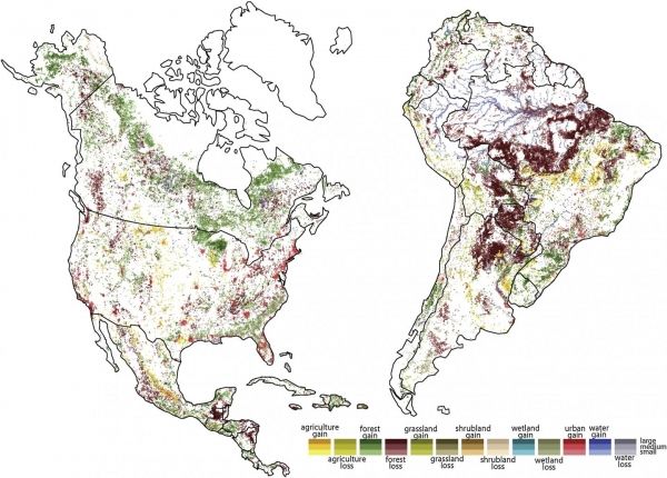
Image: A University of Cincinnati land-use map shows changing landscapes in North and South America between 1992 and 2015. White indicates little or no change. Darker shades indicate the highest rate of change in each category. Forest loss was the most noticeable category in Central and South America. (Credit: Tomasz Stepinski/UC)