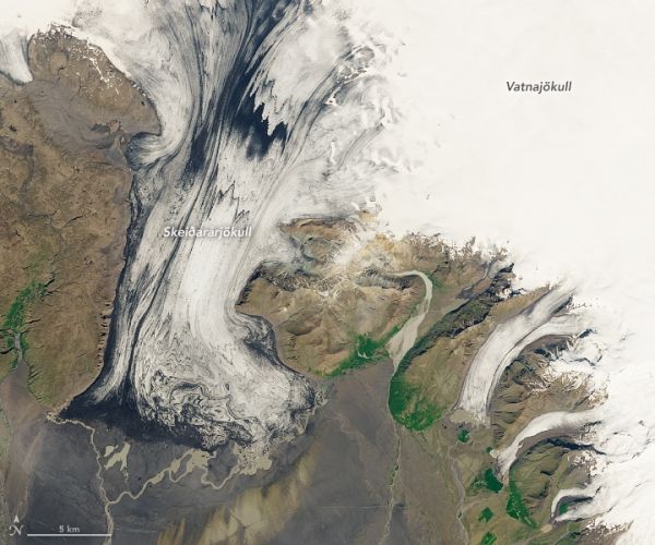
Iceland’s Vatnajökull National Park is one of the rare places in the world where fire and ice lie adjacent to one another. The park is home to eight volcanoes located under glaciers. When one of these subglacial volcanoes erupts, sudden glacial outburst floods—called jökulhlaups in Icelandic—can occur with damaging consequences.
One glacier well-known for jökulhlaups is Skeiðarárjökull, located near one of Iceland’s most active volcanoes, Grímsvötn. Geothermal heat creates a subglacial lake within the volcano’s crater, which leads to massive amounts of meltwater during volcanic eruptions. The subglacial volcano is located approximately 50 kilometers (30 miles) from the end of the glacier (where the meltwater emerges). During these jökulhlaups, the glacier’s meltwater carries sediments away from the glacier and deposit it onto a broad plain. These broad outwash plains, called sandurs, are most commonly found in Iceland.
These first two images on this page show the Skeiðarárjökull glacier on July 2, 2019, as observed by the Operational Land Imager on Landsat 8. The black streaks in the close-up image below are volcanic ash layers that became embedded in the glacier after previous eruptions.
Continue reading at NASA Earth Observatory
Image via NASA Earth Observatory


