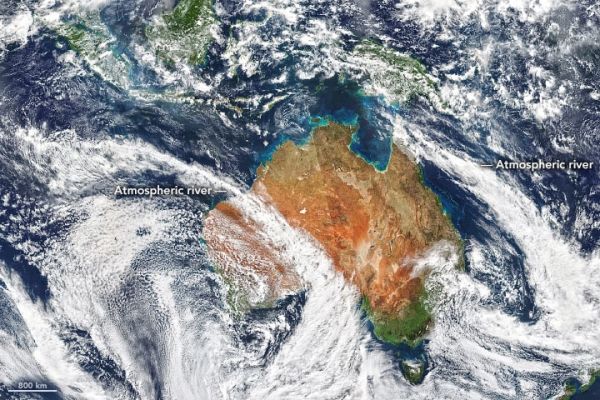
Australian meteorologists took note recently when not one—but two—vast bands of clouds stretched from the eastern Indian Ocean to Australia, channeling streams of moisture that delivered intense rains to both sides of the continent.
Moisture-transporting atmospheric rivers occur all over the world and regularly hit Australia, but it is rare for two of the rainmakers to hit at once, according to Australia’s Bureau of Meteorology. One of them delivered more than 150 millimeters (6 inches) of rain in less than 24 hours to Western Australia’s Nullabar Coast, a dry area that typically receives 24 millimeters of rain in the whole of August. The second system dropped large volumes of rain on New South Wales.
The Visible Infrared Imaging Radiometer Suite (VIIRS) on the NOAA-NASA Suomi NPP satellite captured this natural-color image of the cloud bands on August 10, 2010.
Continue reading at NASA Earth Observatory
Image via NASA Earth Observatory


