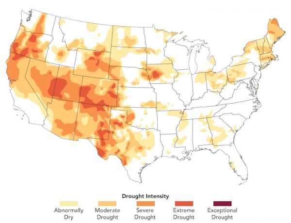
As the United States moves into the last weeks of climatological summer, one-third of the country is experiencing at least a moderate level of drought. Much of the West is approaching severe drought, and New England has been unusually dry and hot. An estimated 53 million people are living in drought-affected areas.
The map above shows conditions in the continental U.S. as of August 11, 2020, as reported by the U.S. Drought Monitor program, a partnership of the U.S. Department of Agriculture, the National Oceanic and Atmospheric Administration, and the University of Nebraska–Lincoln. The map depicts drought intensity in progressive shades of orange to red and is based on measurements of climate, soil, and water conditions from more than 350 federal, state, and local observers around the country. NASA provides experimental measurements and models to this drought monitoring effort.
Continue reading at NASA Earth Observatory
Image via NASA Earth Observatory


