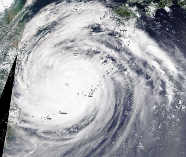
The imagery revealed the eye of the storm had reappeared. The Moderate Resolution Imaging Spectroradiometer or MODIS instrument that flies aboard NASA’s Terra satellite captured a visible image of Tropical Storm Maysak on Sept. 1. In the image, the eye was again visible after being obscured by clouds during the previous day, Aug. 31. Satellite imagery depicts deep convection and spiral banding of thunderstorms wrapping tightly into a low-level circulation center.
Satellite imagery was created using NASA’s Worldview product at NASA’s Goddard Space Flight Center in Greenbelt, Md.
Continue reading at NASA Goddard Space Flight Center
Image via NASA Goddard Space Flight Center


