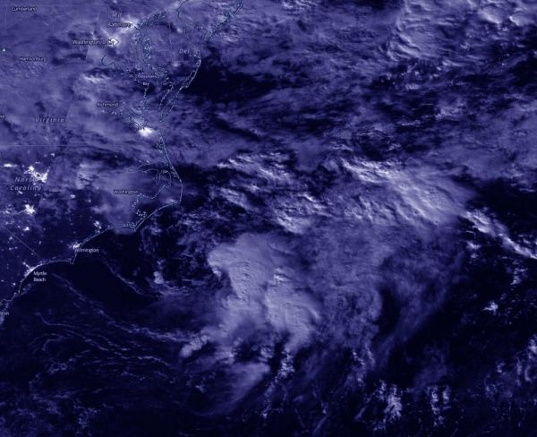
Ocean swells from the depression are affecting coastal North Carolina today, Sept. 1. Tropical Depression 15 formed by 5 p.m. EDT off the coast of North Carolina and showed organized convection (rising air that forms the thunderstorms that make up a tropical cyclone). The storm has been battling vertical wind shear since its formation, which has kept it from intensifying into a tropical storm.
The Visible Infrared Imaging Radiometer Suite (VIIRS) instrument aboard Suomi NPP provided a nighttime image of 15 during the early morning hours of Sept 1 when it flew over the northwestern Atlantic Ocean. Infrared data showed the most powerful thunderstorms east of center where cloud top temperatures were as cold as or colder than minus 70 degrees Fahrenheit. Deep convection remains displaced to the east and southeast of the depression’s low-level center due to increasing west-northwesterly wind shear.
Continue reading at NASA Goddard Space Flight Center
Image via NASA Goddard Space Flight Center


