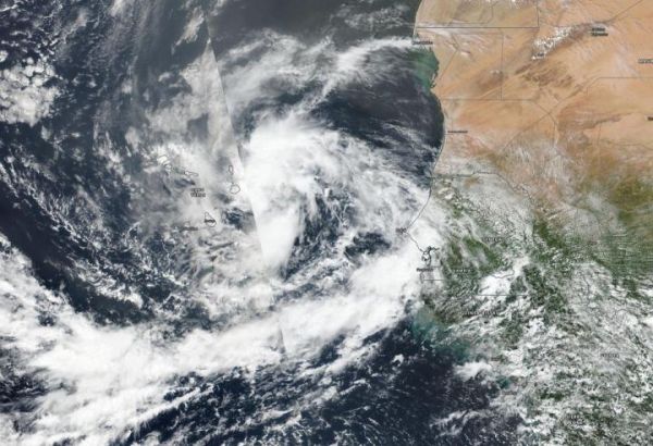
NASA-NOAA’s Suomi NPP satellite provided forecasters with a visible image of the latest tropical cyclone in the North Atlantic hurricane season. Tropical Storm Rene was bringing tropical-storm force winds and rain to the Cabo Verde Islands.
Cabo Verde, also known as Cape Verde, is a country consisting of a chain of islands, located about 385 miles (620 km) off the west coast of Africa.
Tropical Depression 18 developed on Monday, Sept. 7 in the far eastern North Atlantic Ocean, about 250 miles (405 km) east-southeast of the Cabo Verde Islands. By 5 p.m. EDT (2100 UTC) on Sept. 7, the depression strengthened into a tropical storm and was renamed Rene.
Read more at: NASA/Goddard Space Flight Center
On Sept. 8, NASA-NOAA's Suomi NPP satellite provided forecasters with a visible image of Tropical Storm Rene over the Cabo Verde islands in the eastern North Atlantic Ocean. The African coast is seen to the east (right). (Photo Credit: NASA Worldview, Earth Observing System Data and Information System (EOSDIS))