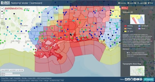
The U.S. Geological Survey announced Friday the completion of a new mobile tool that provides real-time information on water levels, weather and flood forecasts all in one place on a computer, smartphone or other mobile device.
The new USGS National Water Dashboard, or NWD, provides critical information to decision-makers, emergency managers and the public during flood events, informing decisions that can help protect lives and property.
“The National Water Dashboard is a much-needed advancement that will help keep communities across the country safe during extreme weather conditions,” said Tim Petty, Ph.D., Department of the Interior Assistant Secretary for Water and Science, from an agricultural round table with the Water Subcabinet in Janesville, Wisconsin. “The development of a comprehensive tool that can provide real-time, critical information on mobile devices is great news for areas in our country that are prone to flooding or drought. In addition to giving the public key information on what’s happening in their communities, it will also help improve the response of federal, state and local agencies during storms, floods and drought conditions.”
Continue reading at United States Geological Survey
Image via United States Geological Survey