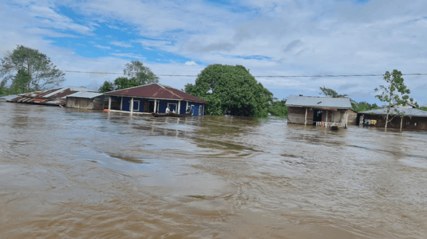
Shortly after Category 4 Hurricane Iota began to drench Central America on Nov. 16, 2020, Claudia Herrera watched from a helicopter as ruinous flood water inundated entire neighborhoods of La Lima, in Honduras’ Valley of Sula. In just three days, the catastrophic rainfall of Iota had flooded Ramon Villeda Morales International Airport in La Lima, as well as schools, healthcare centers, and other critical infrastructure in a region that serves as the country’s main economic engine.
The view from the helicopter was too familiar for Herrera, who leads the Coordination Center for Disaster Prevention in Central America, or CEPREDENAC for its acronym in Spanish. Two weeks earlier, Category 4 Hurricane Eta had battered the region, with Honduras bearing the brunt of the storm’s cataclysmic force. Herrera had been helping regional authorities plan their response to the storms’ destructive winds and heavy rain, which had also scarred important mangroves in Nicaragua and triggered deadly landslides in Guatemala.
Soon after Eta touched down in northern Nicaragua on Nov. 3, NASA’s Earth Applied Sciences Disasters program area began working with Herrera and other authorities in Central America to use satellite images and data to monitor damage and help teams on the ground analyze the affected terrain as they rescued people affected by the storm.
Read more at: NASA/Goddard Space Flight Center
The streets in San Pedro Sula on November 6, 2020. The information Herrera and others in Central America received in 2020 included satellite images to see the storms’ damage to power grids, highways and other important parts of the landscape. (Photo Credit: Coordination Center for Disaster Prevention in Central America)


