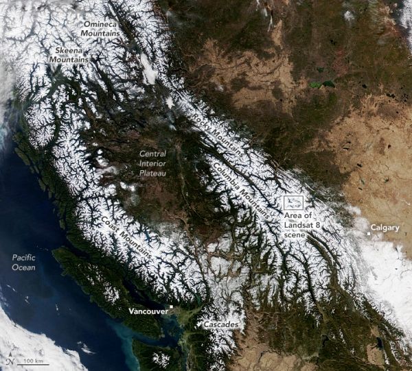
The U.S. and Canadian West have been hit with wave after wave of Pacific moisture in recent weeks, producing substantial amounts of rain and snow across the region. But between storm systems, clear skies opened up for nearly a thousand miles from the coast to the interior, giving satellites a rare cloud-free view the region’s major mountain ranges.
The Visible Infrared Imaging Radiometer Suite (VIIRS) on the NOAA-20 satellite acquired this image during the widespread “unusually pleasant” weather on October 31, 2021. Snowcapped peaks are visible across numerous ranges and subranges, from the Coast Mountains in British Columbia to the Rockies in western Alberta.
Some of the highest mountain peaks stay white year-round, capped with snow and glacial ice that survive summertime melting. But compared to August 2021, snow cover spanned a much larger area in late October following the series of storms. In the week prior to this image, atmospheric rivers carried copious amounts of rain to lowlands around Vancouver and heavy snow at higher elevations. East of the Rockies, Calgary received its first major snowfall of the season.
Continue reading at NASA Earth Observatory
Image via NASA Earth Observatory