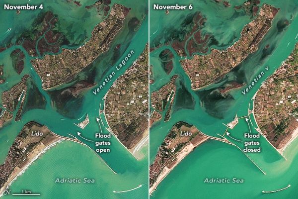
After a planning and construction process that spanned decades, a flood control system in Venice is now regularly protecting the low-lying city from high water. Satellites caught a rare glimpse of the system in action during a high-water storm event in November 2021.
The system—Modulo Sperimentale Elettromeccanico (MOSE)—includes 78 submerged barrier gates that are normally tucked into the seafloor. When weather forecasts show damaging floods (above 130 centimeters or 4.3 feet) are imminent, operators rotate the gates upward to form a temporary seawall that rises above the water surface. As shown by the Landsat and Sentinel-2 images on this page, the seawall prevents water from the Adriatic Sea from flowing through key inlets into or out of the shallow lagoon that surrounds Venice.
On the afternoon of November 3, 2021, the flood gates were raised as a storm brewed in the Adriatic Sea. At the time, forecasters warned that water levels might rise 140 centimeters above normal when high tide peaked and strong sirocco winds battered the Venetian coast. Water at that level is enough to flood 60 percent of the city, including the iconic St. Mark’s Square, the lowest part of the city.
Continue reading at NASA Earth Observatory
Image via NASA Earth Observatory


