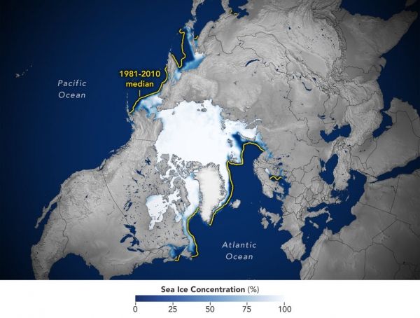
This year’s wintertime extent is the 10th-lowest in the satellite record maintained by the National Snow and Ice Data Center, one of NASA’s Distributed Active Archive Centers.
Arctic sea ice extent peaked at 5.75 million square miles (14.88 million square kilometers) and is roughly 297,300 square miles (770,000 square kilometers) below the 1981-2010 average maximum – equivalent to missing an area of ice slightly larger than Texas and Maine combined. This maximum ties with 2015 as the third earliest on record.
Sea ice waxes and wanes with the seasons every year. In the Arctic, it reaches its maximum extent around March after growing through the colder months, and shrinks to its minimum extent in September after melting through the warmer months. In the Southern Hemisphere, Antarctic sea ice follows an opposite cycle.
Continue reading at NASA Earth Science News
Image via NASA Earth Science News


