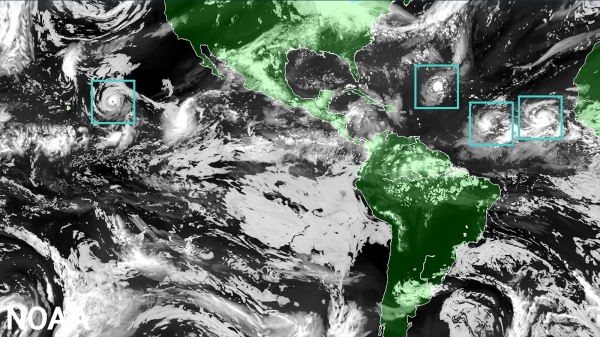
NOAA’s National Hurricane Center — a division of the National Weather Service — has a new model to help produce hurricane forecasts this season. The Hurricane Analysis and Forecast System (HAFS) was put into operations on June 27 and will run alongside existing models for the 2023 season before replacing them as NOAA’s premier hurricane forecasting model.
"The quick deployment of HAFS marks a milestone in NOAA's commitment to advancing our hurricane forecasting capabilities, and ensuring continued improvement of services to the American public," said NOAA Administrator Rick Spinrad, Ph.D. "Development, testing and evaluations were jointly carried out between scientists at NOAA Research and the National Weather Service, marking a seamless transition from development to operations.”
Running the experimental version of HAFS from 2019 to 2022 showed a 10-15% improvement in track predictions compared to NOAA’s existing hurricane models. HAFS is expected to continue increasing forecast accuracy, therefore reducing storm impacts to lives and property.
HAFS is as good as NOAA’s existing hurricane models when forecasting storm intensity — but is better at predicting rapid intensification. HAFS was the first model last year to accurately predict that Hurricane Ian would undergo secondary rapid intensification as the storm moved off the coast of Cuba and barreled toward southwest Florida.
Read more at NOAA
Image: The Hurricane Analysis and Forecast System (HAFS) “moving nest" Model. Global map showcasing land mass in green and water in black, clouds in white and tropical storms outlined in a green boxes representing the moving nest model. (Image credit: NOAA)


