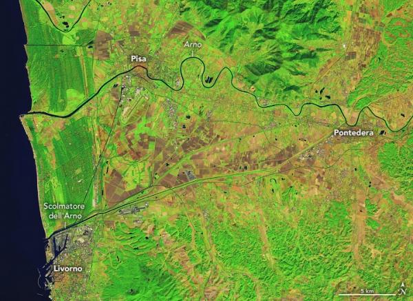
A powerful storm unleashed damaging winds and torrential rain across much of Western Europe in early November 2023. The Tuscany region of Italy was one of the hardest hit areas, where the storm caused widespread flooding visible in satellite images.
Before reaching Italy, the low-pressure storm (named Ciarán by the U.K. Met Office) whipped across Spain, Portugal, the U.K., and France on November 1–2. It delivered hurricane-force wind gusts of up to 164 kilometers (102 miles) per hour in Jersey, an island in the English Channel, and up to 193 kilometers (120 miles) per hour in Brittany, a peninsula on the northwest coast of France.
Next, the storm moved over the Tuscany region of Italy on November 2–3. The images above show water overtopping the Scolmatore dell‘Arno (the Arno floodway) and flooding agricultural fields near the coastal town of Livorno, 75 kilometers (47 miles) west of Florence. The images were acquired by the OLI (Operational Land Imager) sensor on Landsat 8 on October 2 (left) and November 3 (right). These images are false-color, such that water appears blue, vegetation is green, and bare ground is brown.
Read more at NASA Earth Observatory
NASA Earth Observatory image by Lauren Dauphin, using Landsat data from the U.S. Geological Survey.


